Typhoon "Kanu" will affect the Northeast in the north! Need to guard against the influence of wind and rain
On August 8, the Central Meteorological Observatory pointed out in the national weather conference that the No.6 typhoon "Kanu" will move to the north-west direction this year, which will bring wind and rain impact to the northeast of China in the future. The Central Meteorological Observatory continued to issue a typhoon blue warning.
Some time ago, the path of Typhoon Kanu has changed many times, and the prediction of its landing location has been constantly adjusted. Will the path of Kanu change? To what extent can it affect the wind and rain in northeast China? Zhou Guanbo, chief forecaster of the Central Meteorological Observatory, explained them one by one.
The moving path is northwest, but there is still uncertainty.
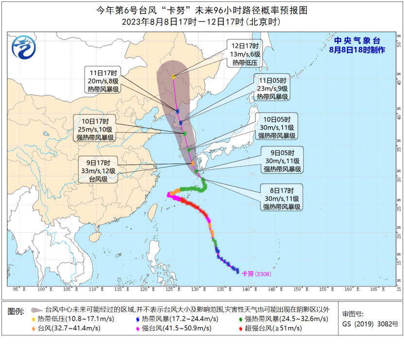
At 29.5 degrees north latitude and 130.7 degrees east longitude, at 17: 00 on August 8, Typhoon Kanu was located in the northwest Pacific Ocean about 225 kilometers south of Kagoshima, Kyushu, Japan. The maximum wind force near its center reached 11 (30m/s), which was a strong tropical storm.
Previously, Typhoon Kanu moved a little less, but it seems to be accelerating in the foreseeable future.
The Central Meteorological Observatory predicts that Typhoon Kanu will move west of journey to the south at a speed of about 10 kilometers per hour, and its intensity will be enhanced, and it will gradually approach the southern coast of the Korean Peninsula. "Kanu" landed on the southern coast of the Korean peninsula on August 10 and entered the northeast of China on August 11.
Zhou Guanbo said that due to the joint influence of subtropical high and westerly trough in the north, there are still uncertainties in the path prediction of typhoon Kanu. At present, it is impossible to rule out the possibility that Kanu will move into the Yellow Sea after passing the southwest coast of the Korean Peninsula, and then approach the coast from Shandong Peninsula to Liaodong Peninsula. In view of this, it is necessary to pay close attention to the moving path of Kanu in the future.
The influence scope is generally small, mainly concentrated in the northeast.
As "Kanu" approaches step by step, its possible wind and rain impact has also attracted much attention.
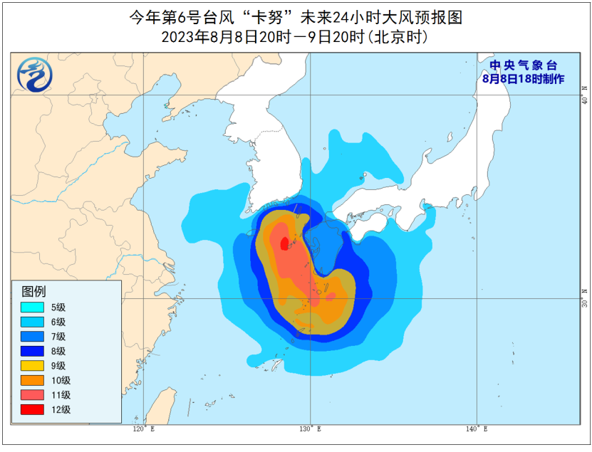
Under the influence of Kanu, there were 6-7 winds in bashi channel, northern Taiwan Province Strait, east of Taiwan Province, south and east of the East China Sea and the waters near Diaoyu Island on August 8-9, with winds of 8-10 in some waters in the east of the East China Sea, 11-12 in the waters near Kanu Center and 13-14 in gusts.
The Central Meteorological Observatory predicts that the peripheral cloud system of Kanu will affect the vicinity of the junction of Jilin and Heilongjiang from August 10, and from August 10 to 12, it will be affected by the westerly trough and typhoon Kanu, with heavy rain or heavy rain in the east and north of Northeast China and heavy rain in the local area.
Zhou Guanbo analyzed that when "Kanu" went north to the northeast of China, with the help of the westerly trough, it was conducive to the long-term maintenance of circulation in the later period and easy to form stable precipitation. Generally speaking, compared with the greater impact of Typhoon Du Surui on North China, the impact of Kanu is not large, and the precipitation is mainly concentrated in the east and north of Northeast China. (China Meteorological Bureau)